
“Geography is not restricted to computer desks and programming but it connects us with the spatial or geographic logic. It opens up our lives to the vast canvas of the real world”
Mentioned by Dr Priyank Pravin Patel who is an Assistant Professor of Geography at Presidency University, Kolkata unwraps the true potentiality of the geographic knowledge. The essence of Geography is not to just preparing a map, but also to find out true geographic logic behind it.
Dr Patel was speaking at an online panel discussion on “The Science of Places: Exploring the Career Goals and Competencies of Future Geographer” hosted by Department of Geography, School of Basic and Applied Sciences of Adamas University, Kolkata on 31st March 2020. The panel discussion aimed to showcase the career path to future geographers as a ray of hope amidst COVID-lockdown. Prof. Bimal Kumar Sarkar, Dean, School of Basic and Applied Sciences, Adamas University; Dr Nandini Chattopadhay, Senior Faculty at Calcutta International School, Kolkata; Mr Shakya Ganguly, Assistant Teacher, Bombay Scottish School, Mahim; Dr Jhilli Das Tewary, Head, Department of Psychology, Adamas University and Mr Abhijit Giri, Director, Career Development Cell and Group Outreach, Adamas University were the other panellists of the session. With more than 520 registered participants from more than 10 states of India, the discussion addressed various queries raised by the participants related to career prospects and planning in the field of geography and geoinformatics. Geoinformatics, the science and technology which develops and applies information science infrastructure to address location-based problems, offers most lucrative job-opportunities among youngsters, particularly those are coming from geography, computer science, engineering, physics and IT backgrounds. The wider entrants in the field of geoinformatics outside geographical domain, questions the credibility of Geography in the domain of geoinformatics, very relevant question pointed out by Dr Nandini Chattopadhay.
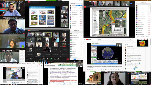
Screen Shots of Panel Discussion on The Science of Places: Exploring the Career Goals and Competencies of Future Geographer hosted by Department of Geography, School of Basic and Applied Sciences of Adamas University, Kolkata on 31st March 2020 (Picture Edits and Compilation: Ms. Kasturi Mukherjee, HOD, Department of Geography, SOBAS)
Geography, the science of where, what, when, why, and how does not restrict itself to the computer desks and programming languages, however, it opens up the wider horizon of knowledge, encompassing distinct dimensions of physical environment and society and empowers to solve real-real world problems applying geographical information system. A computer engineer may create a complex spatial algorithm to solve locational problems, but it is a geographer who who may decipher the spatial rationale behind it, said by Dr Priyank Pravin Patel. Huge curiosity among youngsters on career opportunities in Geography and Geoinformatics at the interdisciplinary platform was the major focus of discussion among panellists. Geography offers a wide-ranging interdisciplinary platform to its students, they develop essential transferrable skills in research, fieldwork, statistics & data science, computer programming and digital cartography. The wider exposure to physical and human environment teaches them geographic reasoning behind its distribution encompassing both the natural and cultural world. Geography students also learn to work with diverse databases, spreadsheets, digital cartography and GIS technologies that open up the more extensive skyline of opportunities.
Career for Geographers
Whether you are Physical Geographer or Human Geographer, the diverse career path is waiting for you in India and abroad. Being physical geographer, one may prefer to explore the earth’s physical properties and processes while if someone is more inclined to human geography, they may take active participation in socio-cultural and economic processes.
Whatever field one may prefer, the future is bright for geography students. The major emerging career options for Physical Geographers include:
- Environmental Consultants and Environmental Health Officer: Works on client contracts on environmental audits impact assessment, pollution, waste management and environmental policy. Major public sector recruiters Ministry of Environment, Forests and Climate Change, Central Pollution Control Board, State Pollution Control Boards etc. Dupont Sustainable Solutions (DSS), AECOM, ERM, Jacobs, Lloyd’s Register, DEKRA Insights are top corporate recruiters active in more than 40 countries.
- Ecologists, Conservation Planner and Nature Conservation Warden: Undertakes floral and faunal studies and implement schemes for the creation and protection of habitats. Nature Conservation Wardens are recruited by national parks, wildlife trusts or private estates.
- Scientific Officer and Field Survey Worker: Designs experiments and field studies and evaluates results.
- Alternative Energy Manager, Recycling officer and Waste Manager: Opened up a wide horizon of lucrative opportunities to accomplish sustainable goals.
- Hydrologists: Who studies water flow through channels and associated rock formations.
- Water Quality Officer/Scientists: Works for water authorities on water sampling, surveys, quality analysis, pollution control and treatment. National River Conservation Directorate (NRCD) in the Ministry of Environment, Forests and Climate Change is the major recruiter at the national level.
- Climatologists, Oceanographers, Environmental Educator, Ecotourism organizer are other favourable opportunities among geographers.
Geography studies the earth as the home of people and here the major role of human geographer emerges. Lucrative career opportunities are on the rise for future Human Geographers:
- Urban Planner/Urban Designer: Under-graduation and Post-graduation degree serves an excellent foundation to opt for a career in Urban Planning. One of the most lucrative and highly paid jobs, strive to design city which is safe, functional and enjoyable. WHO, UNDP, World Bank, MNCs, real estate firms to urban local bodies of every countries and state recruiting urban planners.
- Transportation planner: Works with government, real-estates, MNCs and private organizations to design and organize transit routes for communities, also managing public communication through sharing route information, system overhauls and many more. Geographers with deep knowledge of GIS and GPS technologies are a favourable choice for recruiters.
- Landscape Architecture: Highly interdisciplinary career demands Masters in Architecture to enter, but Geography major students are playing a major role in the field. Designing outdoor spaces such as gardens, college campuses, playgrounds and public parks which are functional, attractive and sustainable is the major tasks of landscape architectures.
- Demographer: Interest in population studies, census data and household statistics is foundation stone for a career in demography. Census Organizations, Bureau of Economics and Statistics, World Bank, Major research companies like Deloitte, KPMG, McKinsey and CII are major recruiters.
- Market Research Analysts: Human geographers who can easily distinguish the behaviour of heterogeneous social groups, serving MNCs to reach their client effectively. Designing customer surveys, conducting market research and analyzing economic data are the major tasks of Market Research Analysts.
- Surveyor and Cartographer: Works with engineers, planners, architectures and mapmakers to survey the land upon which developers plan to build, making the precise measurement, updating boundary lines and playing an essential role in any developmental work. Cartographers are map-makers whose major task is to collect, verify and reproduce geographical information. Public and private mapping organizations, research organizations, real estates, NGOs, academic sectors are major recruiters.
- Health Care Analyst and Public Health Planner: Responsible for compiling and analyzing information and statistics related to health issues for specific communities and populations, to formulate an effective health care policy. Increasing demand for healthcare planners is on the rise with increasing effect of the pandemic. Human geographers with a keen interest in Health and Medical Geography are doing much well in these sectors. Ministries of Health and Family Welfare, National Health Care Systems, corporate and public hospitals are major recruiters.
- Tour Guide: Revealing distinct aspects of the natural and cultural environment to its clients, the Tourism industry is another promising option for geographers. Many tourism agencies, Ministry of culture and tourism, preferring geographers for recruitment.
- Data Scientists and Data Analysts: Up-gradation of geography syllabus and increasing incorporation of neo-geographical tools, statistical algorithms, machine learning, multi-criterion decision-making techniques, computer-programming, SQLs, text-analytics and learning and practices of GIS and statistical packages that enable a geographer to solve complex real-world issue have opened wide career opportunities to geographers in the field of data science. Data scientists, data analysts, big data analysts, spatial data analysts etc. are some of the lucrative jobs paying high salary packages to deserving candidates.
Career prospects in geography never stop here, if you expertise in your favourite domain, curious to know about the earth and its processes, ready to explore human and its habitat, love to participate in outdoors fieldwork, surveying and laboratory activities, Geography has many treasures to gift.


